HORSE CAMPS
Centerpoint Horse Camp
located directly across Hwy 43 from the Centerpoint Trailhead
Website: www.centerpointhorsecamp.com
Caney Mountain Horse Camp
surrounded by the Sylamore National Forest, Lower Buffalo Wilderness Area, and Leatherwood Wilderness Area
Website: www.caneymountain.com
Steel Creek Campground
upper district, about 3 miles east of Ponca, Arkansas, off of Highway 74
GPS Coordinates: 36.0407758, -93.3440483
Sources:
National Park Service - https://www.nps.gov/buff/planyourvisit/horsebackriding.htm
Ozark Mountains - http://www.ozarkmtns.com/buffalo/brhorses.asp
along with beauty on every ride. Whether I am riding with those who have ridden 30,000 miles plus or those who are newer to riding these trails, every ride is always a treasured memory I will never forget. I love this place and I can't help but to feel that it loves me back," Christy Lawson
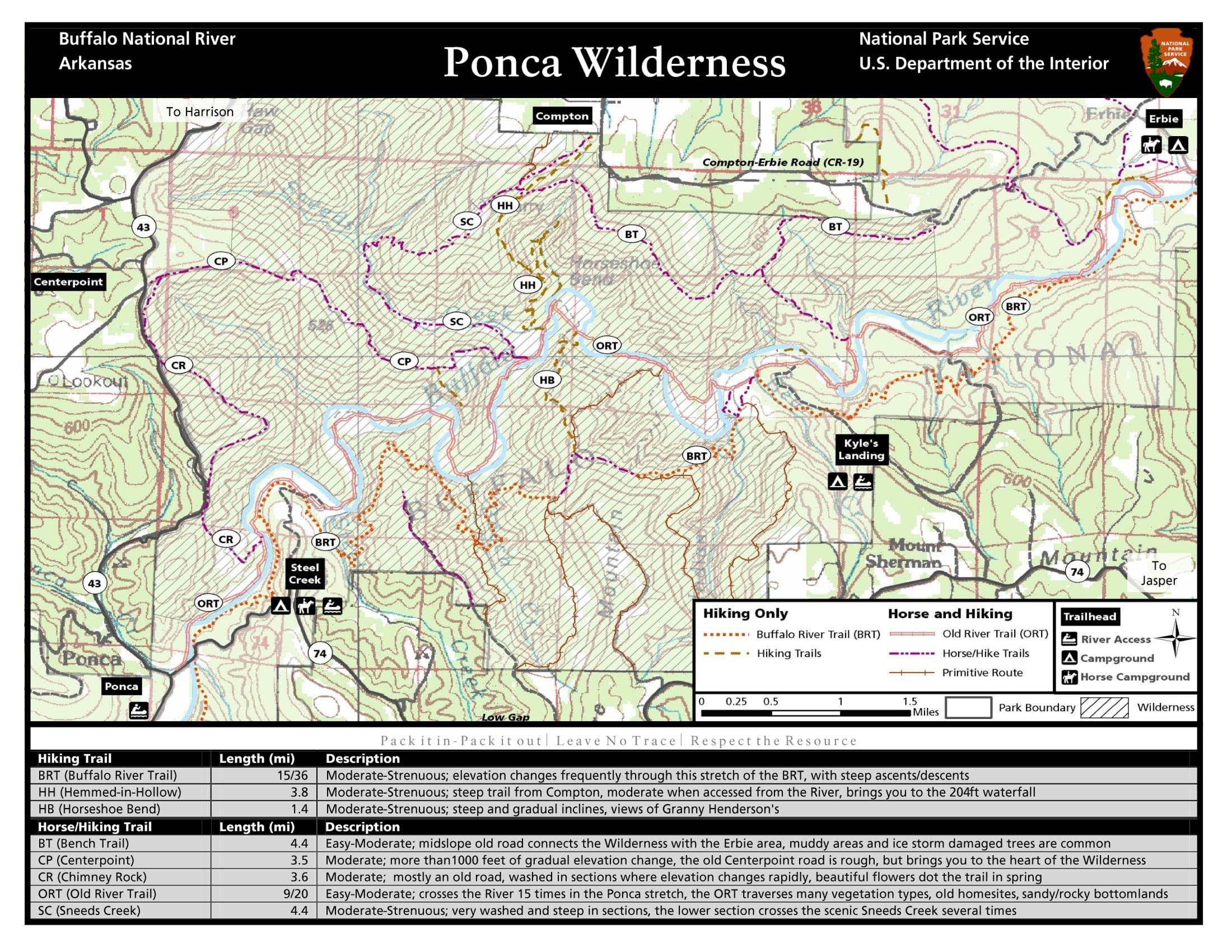
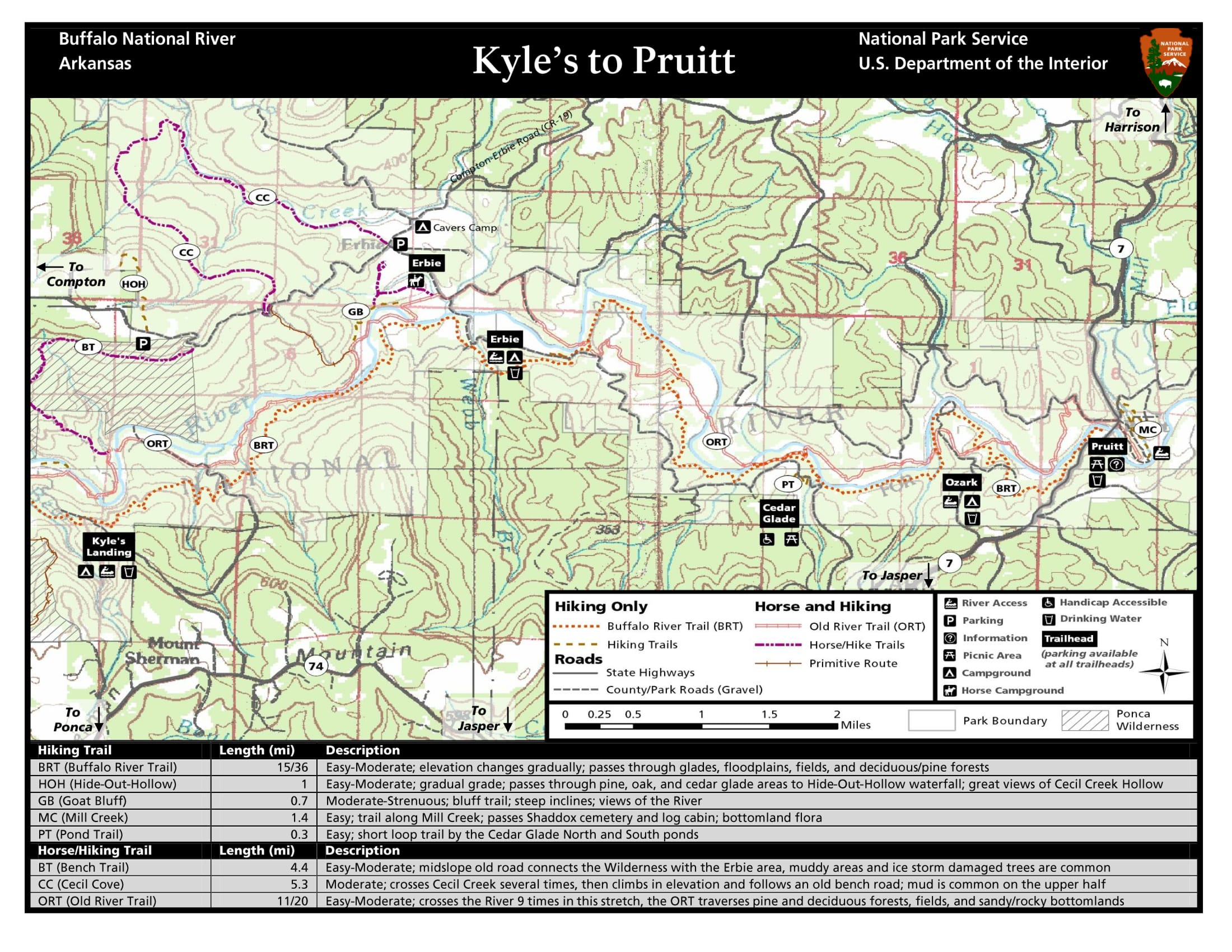
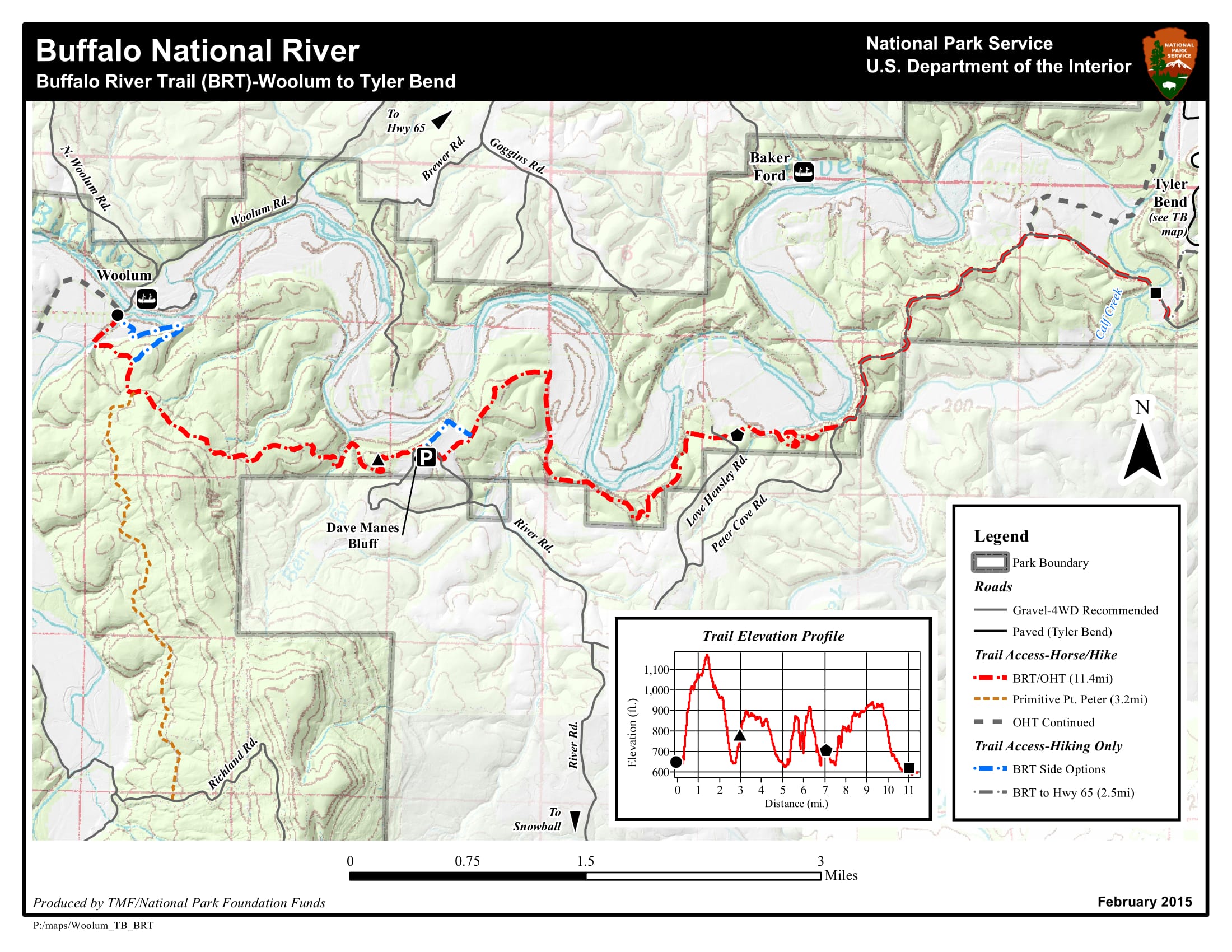
Designated trails for horseback riding are located in all districts of the national river. Two camping areas in the upper river have been designated for visitors with horses. These areas, at Steel Creek and Erbie, are accessible by vehicle. Middle river horse users may overnight at Woolum. Visitors to the Lower Buffalo Wilderness Area may camp at Big Creek or Hathaway Gap Trailheads.
For more information about places to camp or ride on the Buffalo National River, contact the Back Country Horsemen of Arkansas: arkansasbch.org/trails/
Riders from Iowa enjoying a ride on the Buffalo near HWY 7
Ted and Sage riding out of Steel Creek Horse Camp going to the Low Gap Cafe for a great lunch six miles from Camp
TRAIL MAPS
• Kyle's Landing to Pruitt Trails
Photo by Ted Spears